Video
We just implemented an option for defining selected features color. If you have a specific color you would like your maps to have features selected in, we have it!
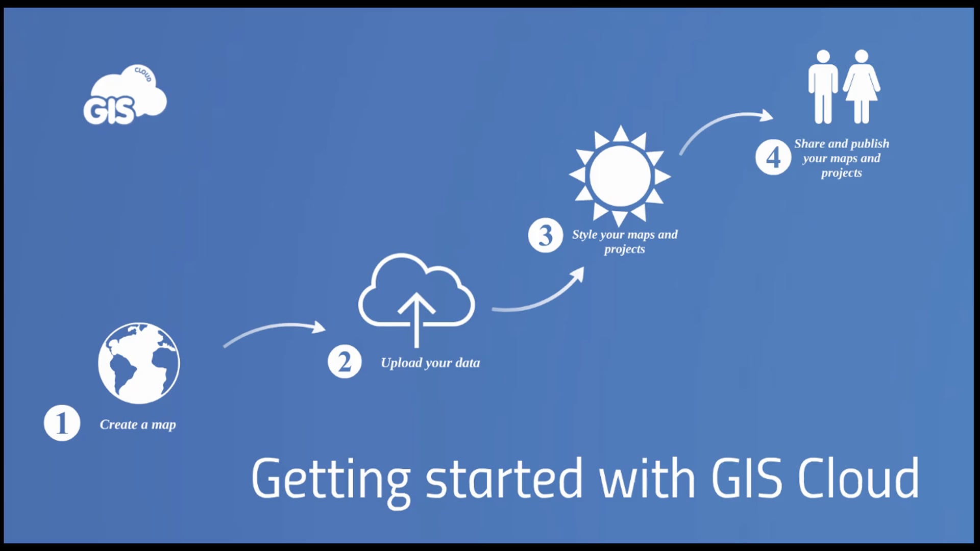
We present you a short video that contains all the needed info and steps on how to get started with GIS Cloud. Check out the 4 basic steps to start your GIS Cloud mapping adventure
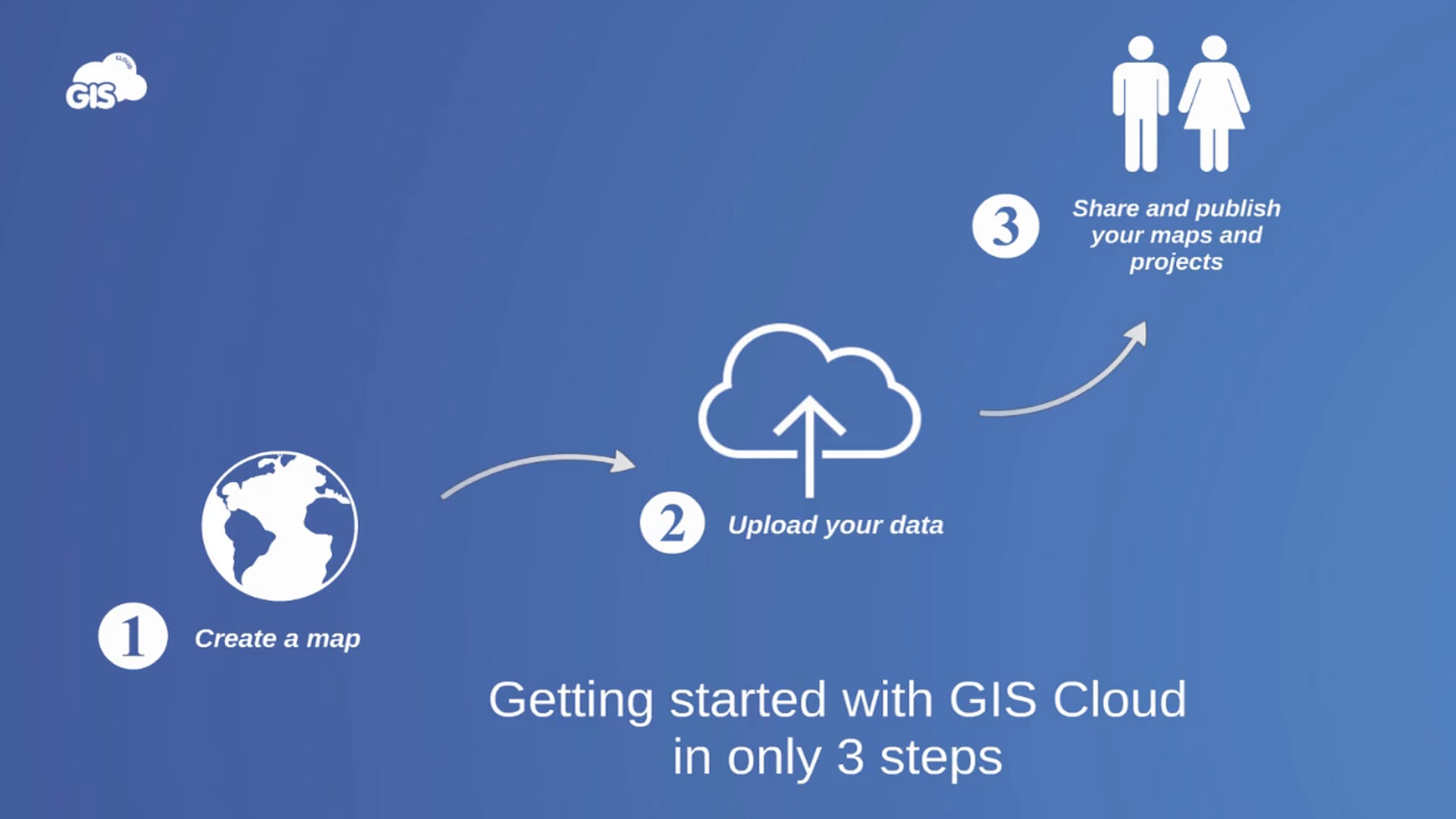
This getting started video shows you how to start with your mapping adventure using GIS Cloud in only 3 steps. From creating a map, uploading your data and sharing it.
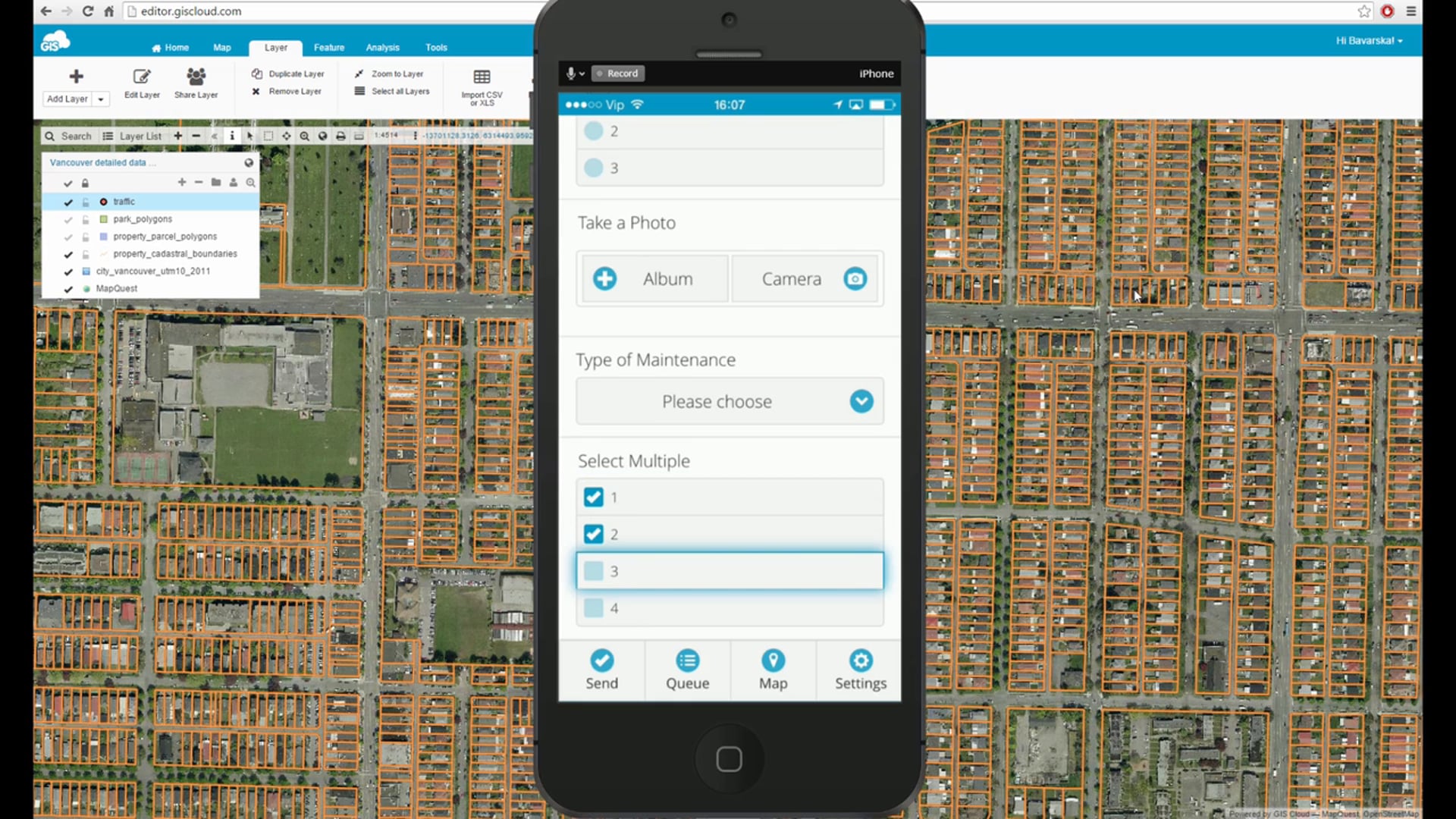
We have released MDC checkbox feature which now enables you to have a multiple selection at the same time. Additionally, this video blog covers steps on how to copy a custom form to a new layer in Map Editor you want to collect the data into. This is a great workflow when there is a need of having multiple layers with the same form, so for instance when tracking the change over time and having the data collected based on one form.
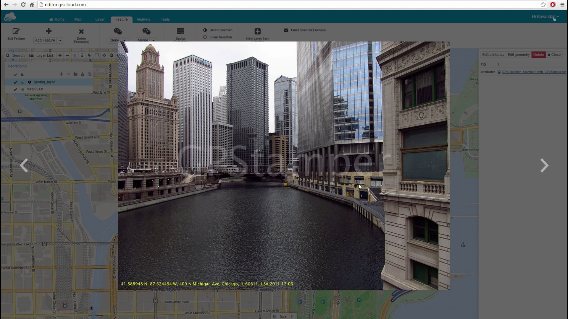
GIS Cloud has implemented the possibility of adding geotagged photos to your point data, where the latitude and longitude attributes (metadata) automatically create a point and zoom into the location of the photos taken.
Check out the video to get more info!
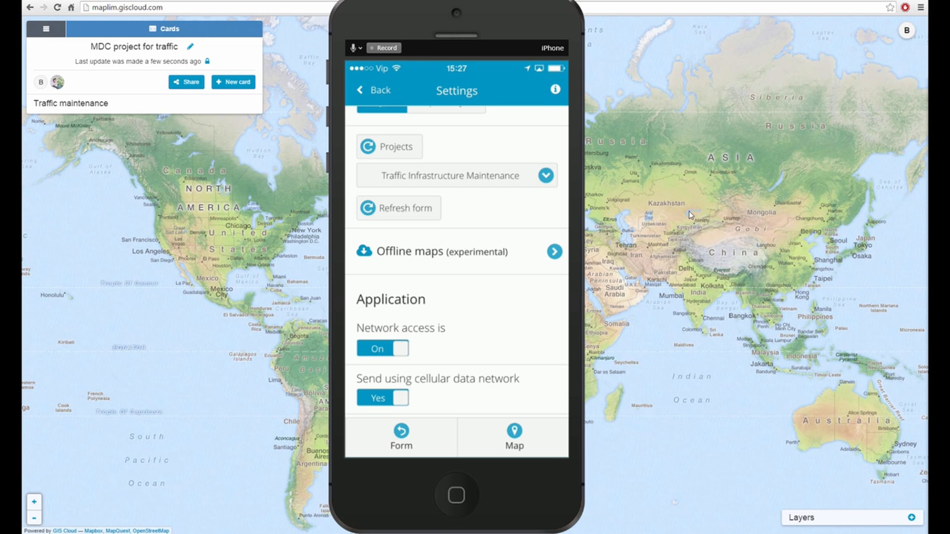
In this video we will show you how to combine Maplim in field data collection projects using MDC mobile app and MDC Portal.
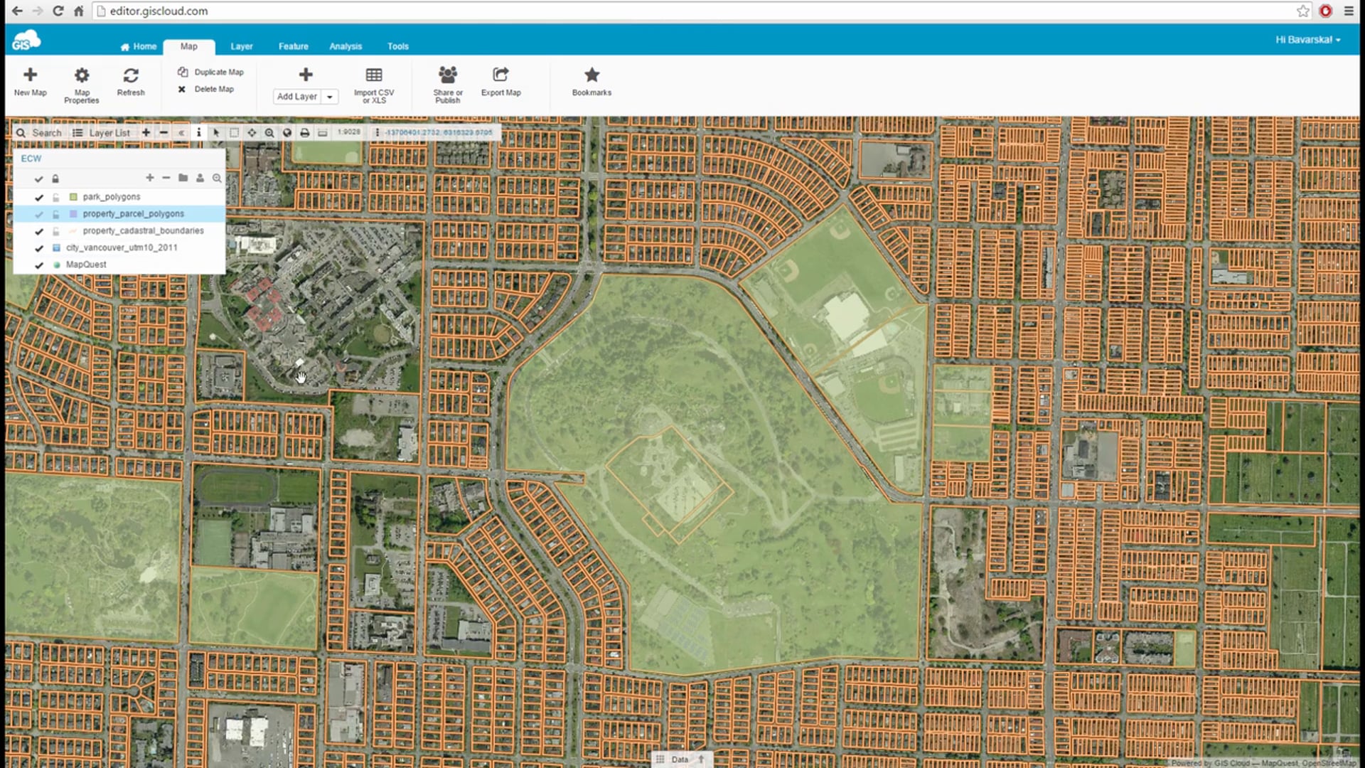
In this video we are covering how to add a large ECW raster data set and GIS Cloud’s fast map performance.
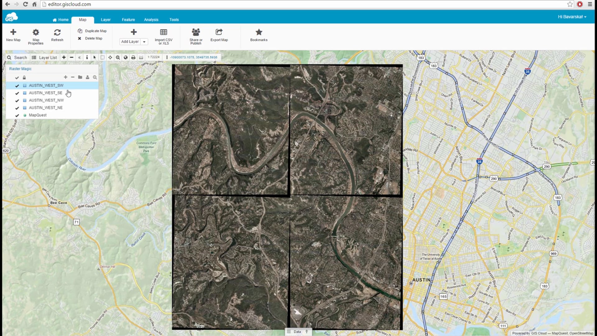
In this video we will show you how to get rid of those annoying black borders and edges when dealing with raster data.
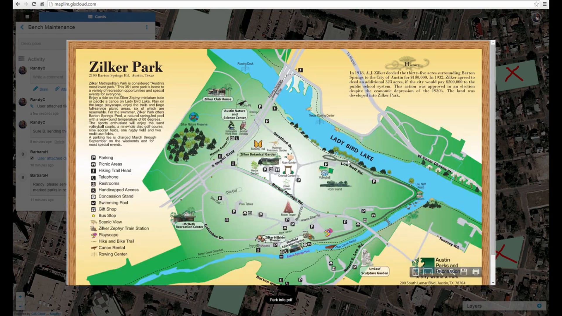
In this video we will show you how the real time collaboration stream works in Maplim along with how to attach relevant documents to your workflow.