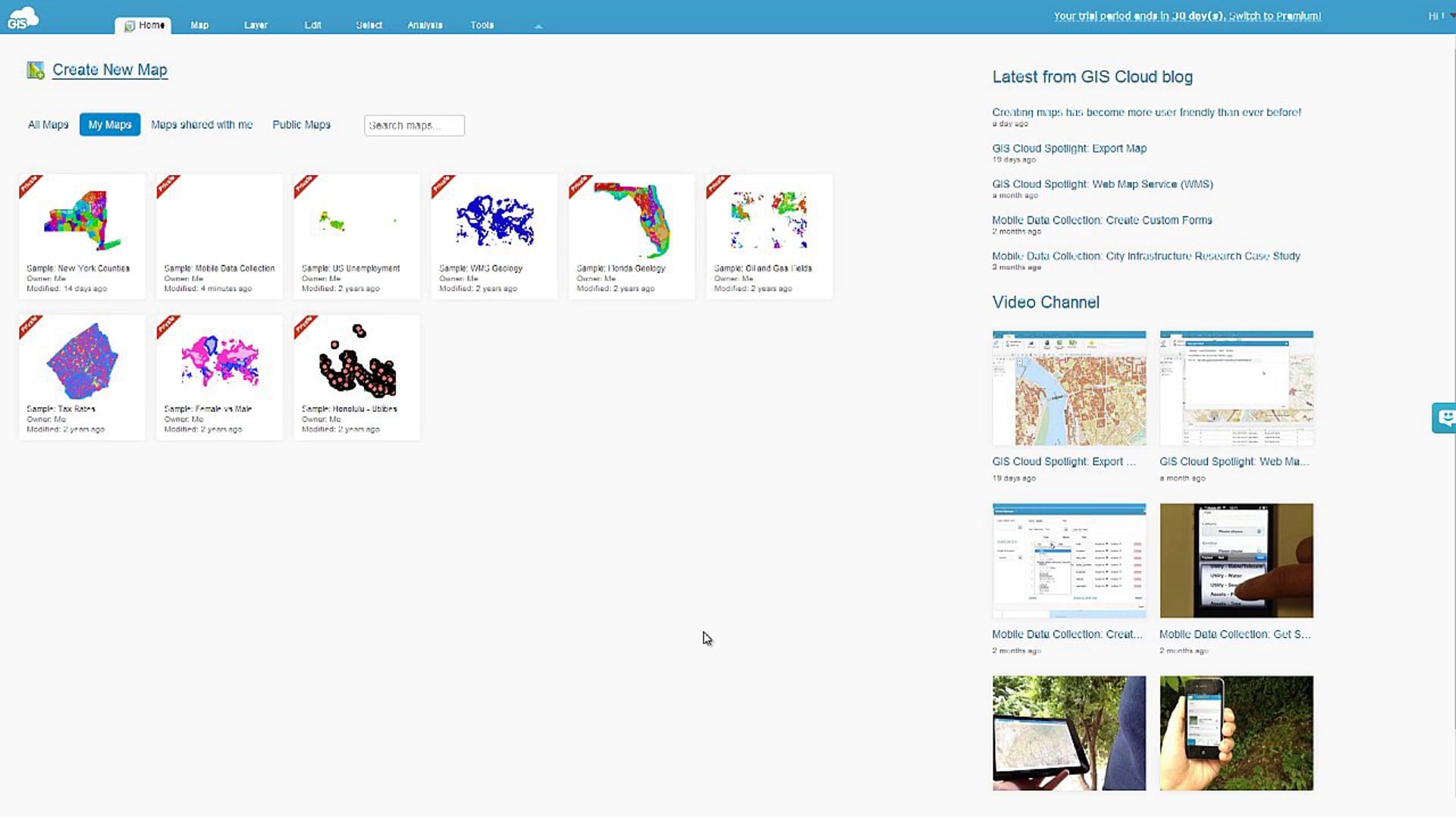
Video
GIS Cloud applications allow you to export all public or private maps you’ve created or someone has shared with you.
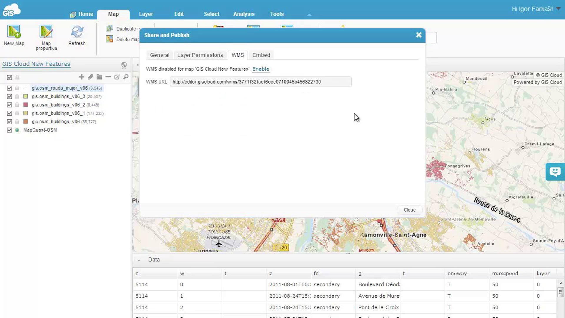
You can easily publish your maps created in GIS Cloud Map Editor application and add them to your projects in different platforms and clients as Web Map Service.
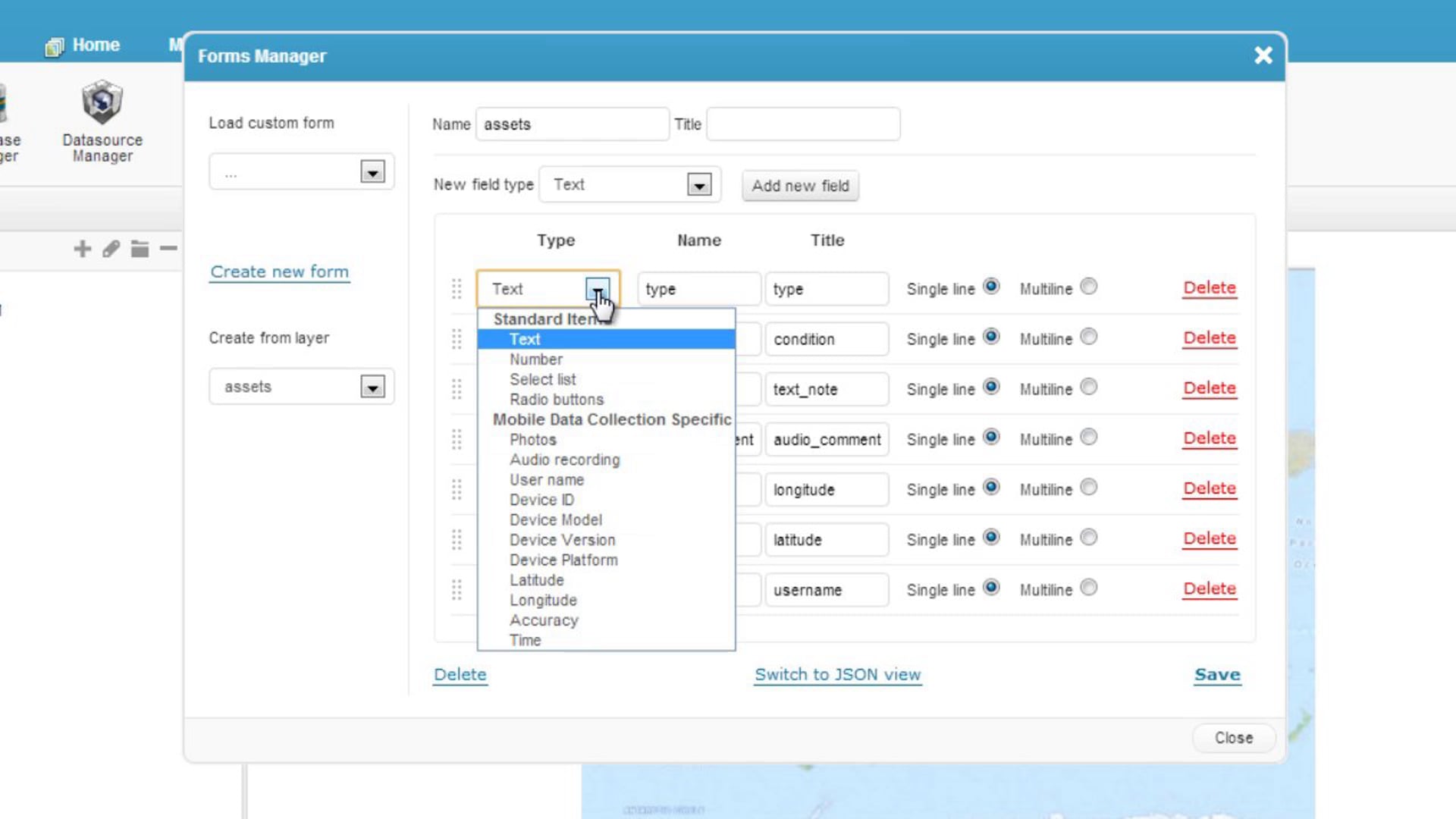
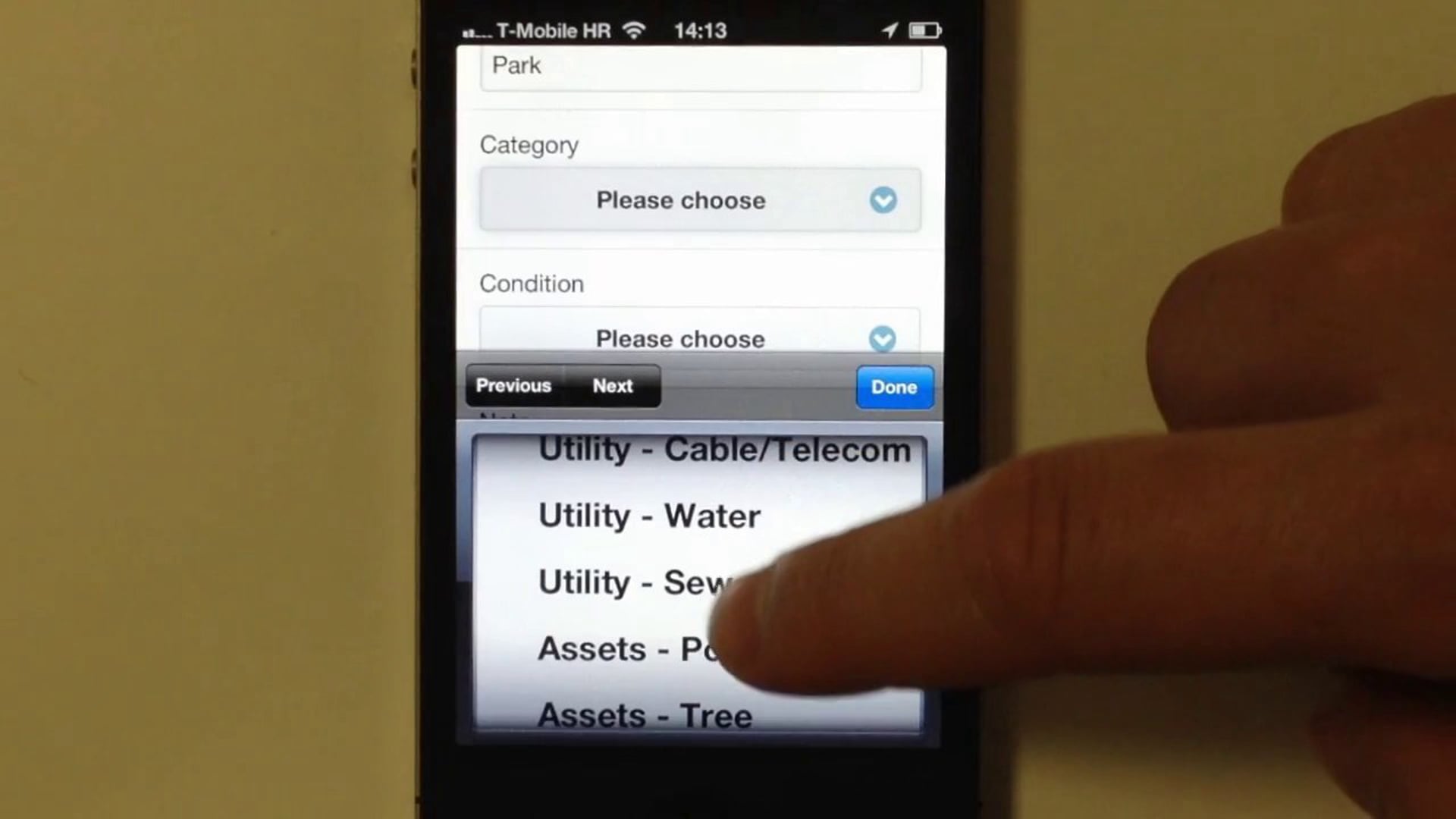
Before you start collecting data you need to create a map, a point layer where you will send your data from the field and create a custom form according to your needs.
Once you download the app and install it on your iOS or Android device simply log in with your existing GIS Cloud account or create a new one right in the application.
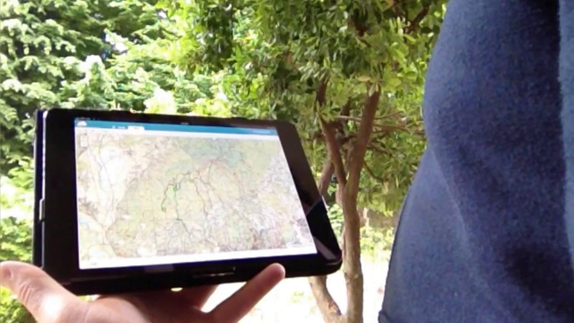
GIS Cloud applications are completely cloud based and run across all of the modern devices which allows you to empower your distributed and mobile workforce to coordinate and collaborate from any location on any device and in real time.
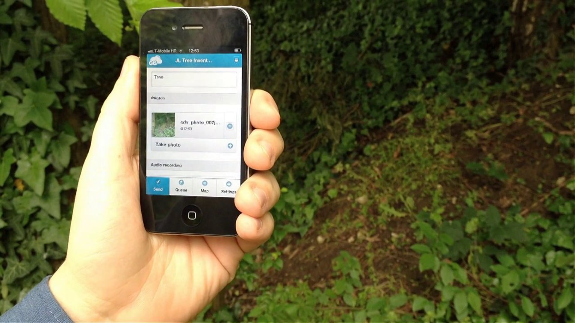
GIS Cloud Mobile Data Collection is a tool for today’s mobile devices which enables you to collect data and conduct field surveys faster and easier than ever before.
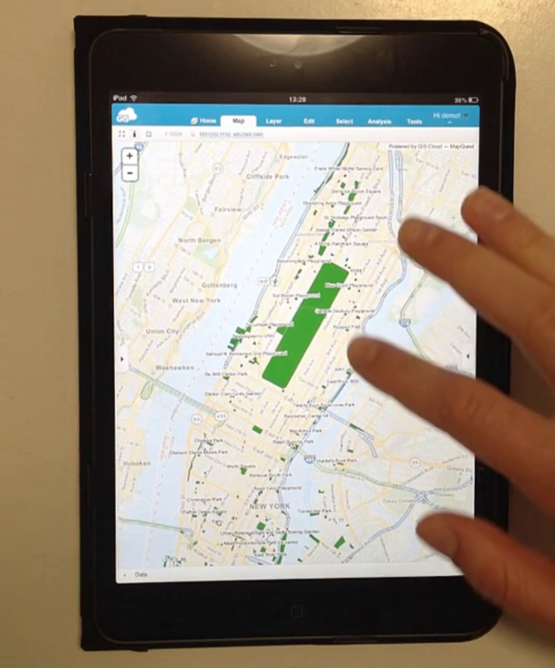
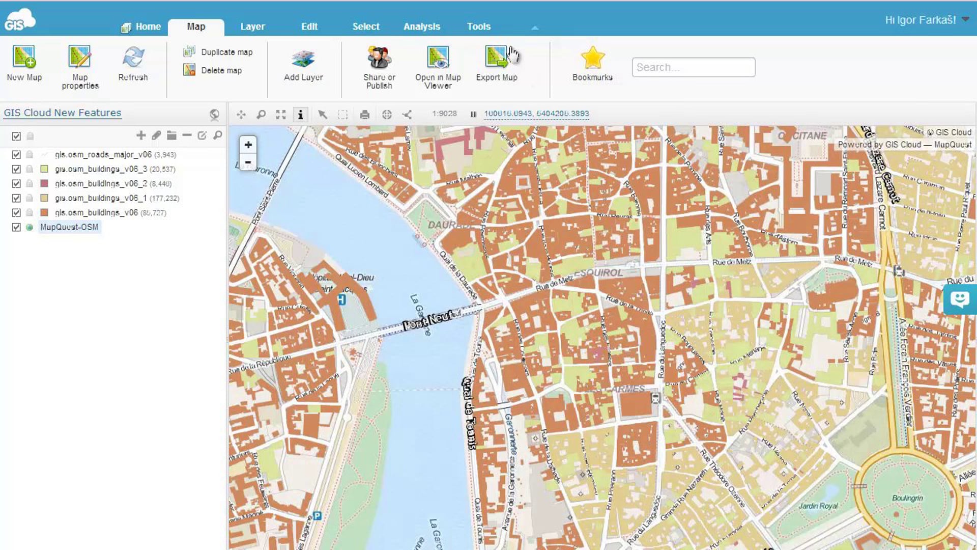
In this preview you can see the true power of our proprietary and optimized vector-based map engine based on the latest HTML5 technology which allows you to run powerful GIS Cloud applications on all of the modern devices no matter where you login.
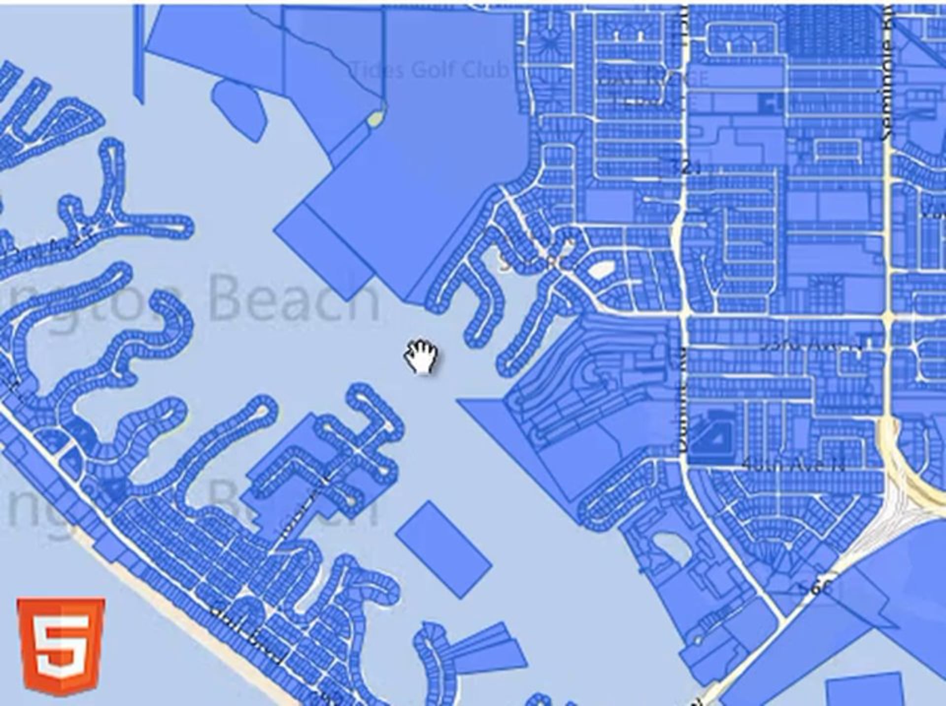
Our optimized vector-based map engine is based on the latest HTML5 technology, and is the fastest map display engine available
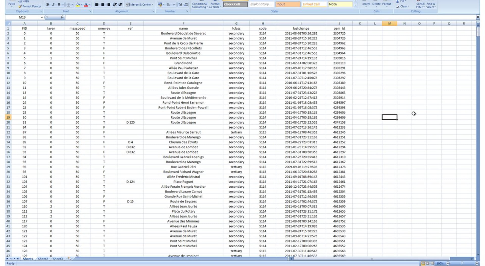
The export attributes tool that allows you to choose between 2 export options: export only those filtered attributes that are visible in the current view or export all the filtered attributes of the selected layer.