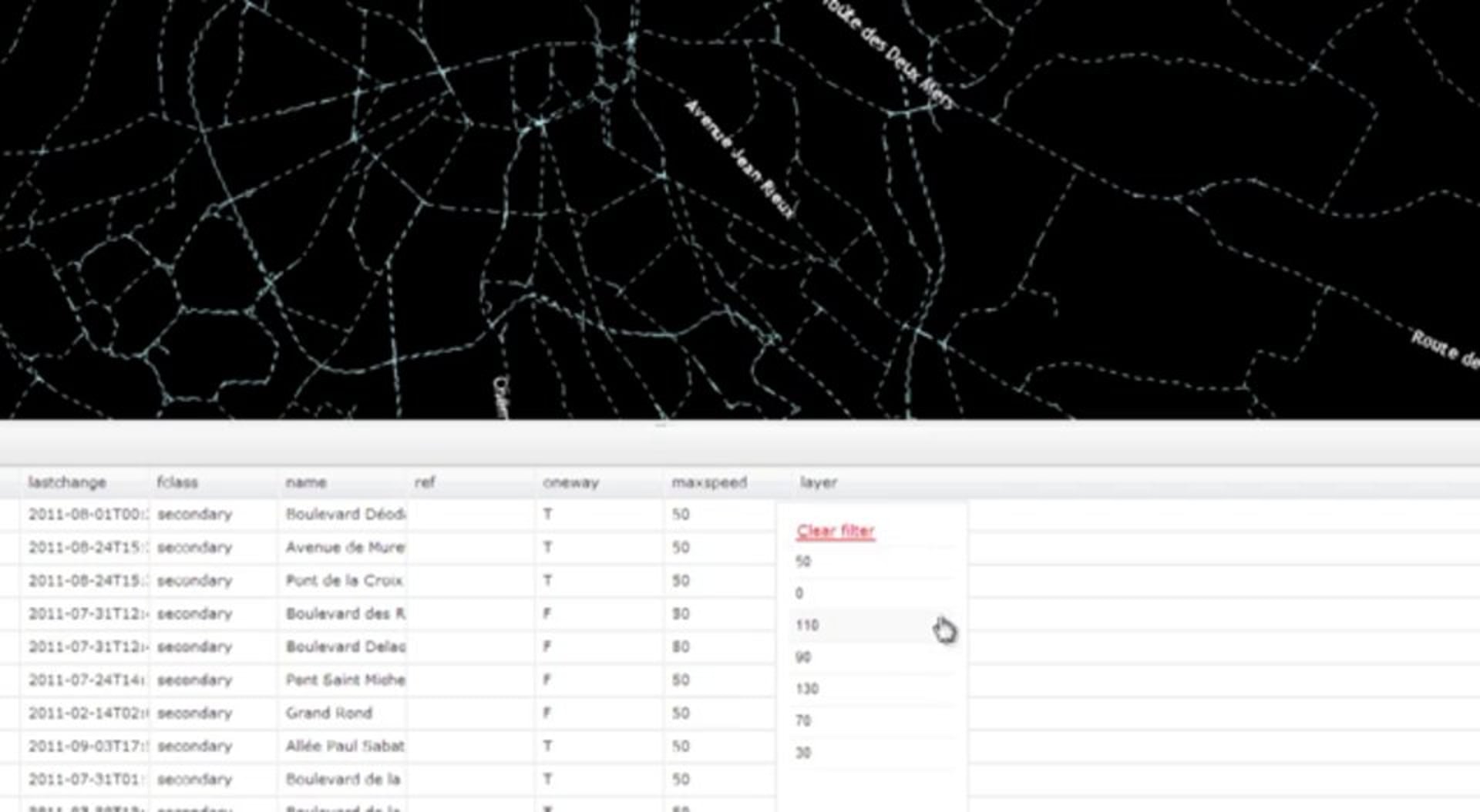
Data filtering tool allows you to filter, find and visualize features by it’s attributes easier and faster than ever before.
Everything you need to know about GIS Cloud apps and platform
Data filtering tool allows you to filter, find and visualize features by it’s attributes easier and faster than ever before.
In today’s video we would like to show you some of the new features that you’ve requested and we’ve implemented in Map Editor application this week.
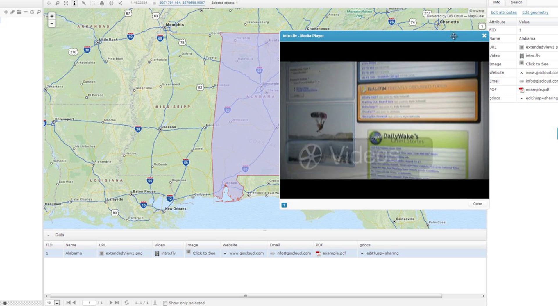
Map Editor allows you to import and view various photos, images and videos; listen to audio files; input various links to other websites such as google docs; attach and view PDF files, send emails and all that directly in the application.
Another great feature is the Email selected features tool which allows you to quickly send the information about your data to other people.
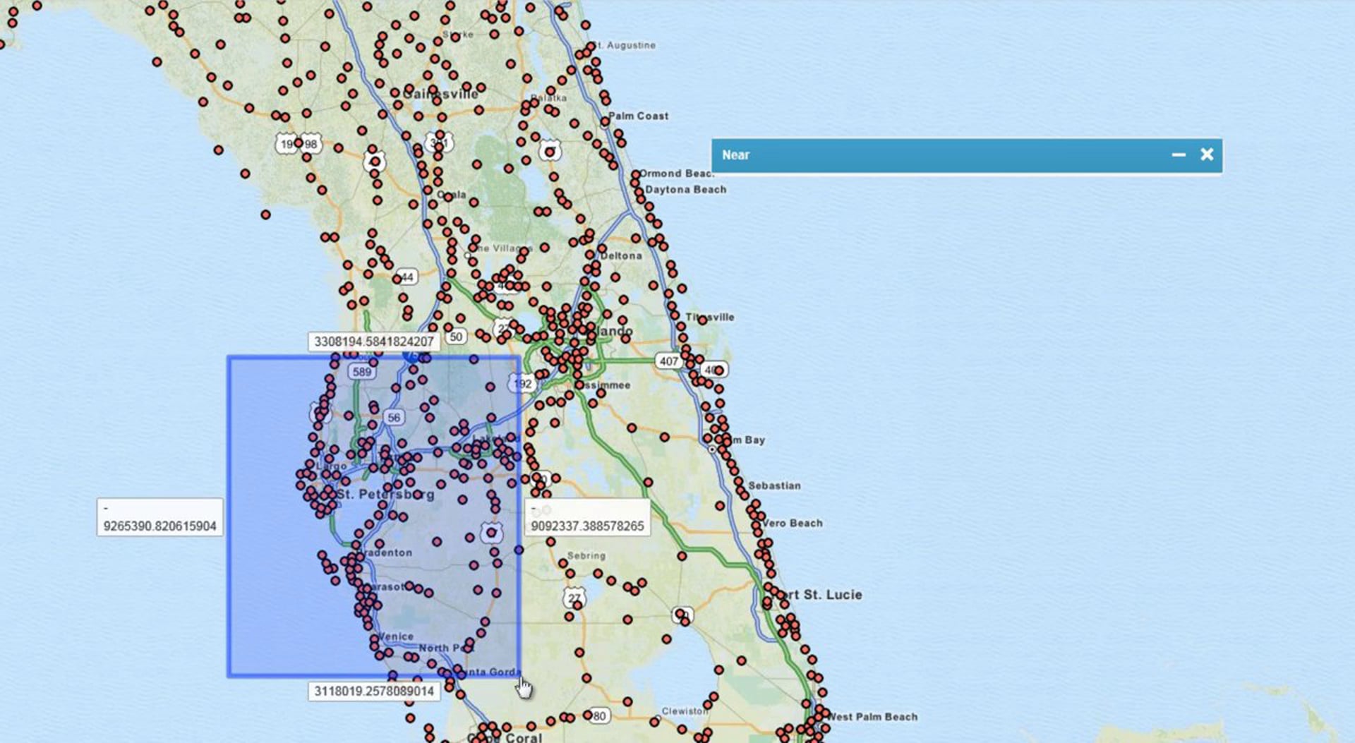
Near analysis is a tool with which you can determine the distance from each feature in a layer to the nearest feature in the same layer, within the specified search radius.
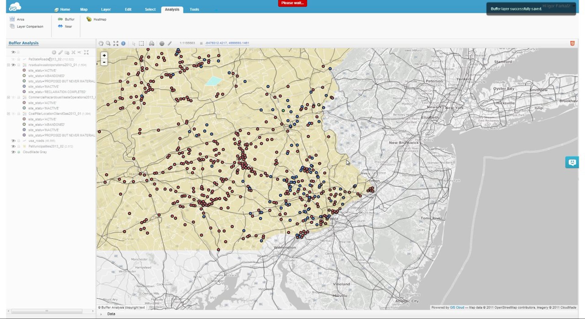
Buffer analysis creates buffer polygons to a specified distance around the point, line or polygon features.
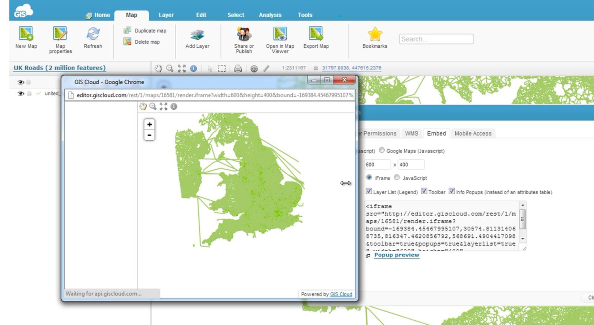
Choosing the embed tab on the Share and Publish panel allows you to easily extract the code of your map necessary for embedding it into the website.
Visit http://www.giscloud.com/blog/gis-cloud-starts-html5-mapping-revolutionto explore the map embeds.
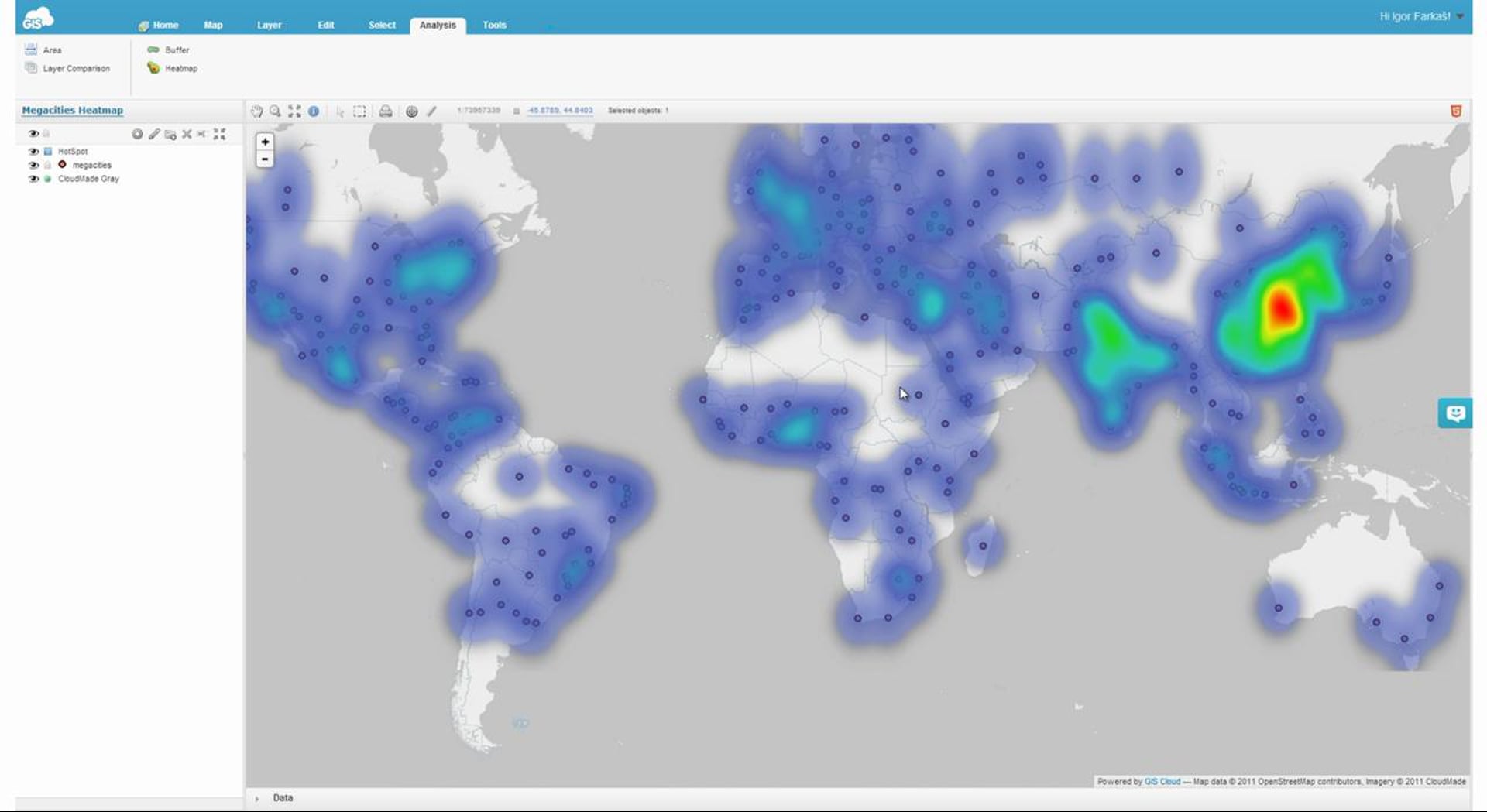
Heatmaps are a way of visualizing the concentration of points within a specified geographical area where the individual values are represented as colors.
Explore the map:
http://editor.giscloud.com/map/101184/megacities-heatmap
![]()
Learn how you can access, upload and maintain your data by connecting to GIS Cloud with Secure File Transfer Protocol clients.
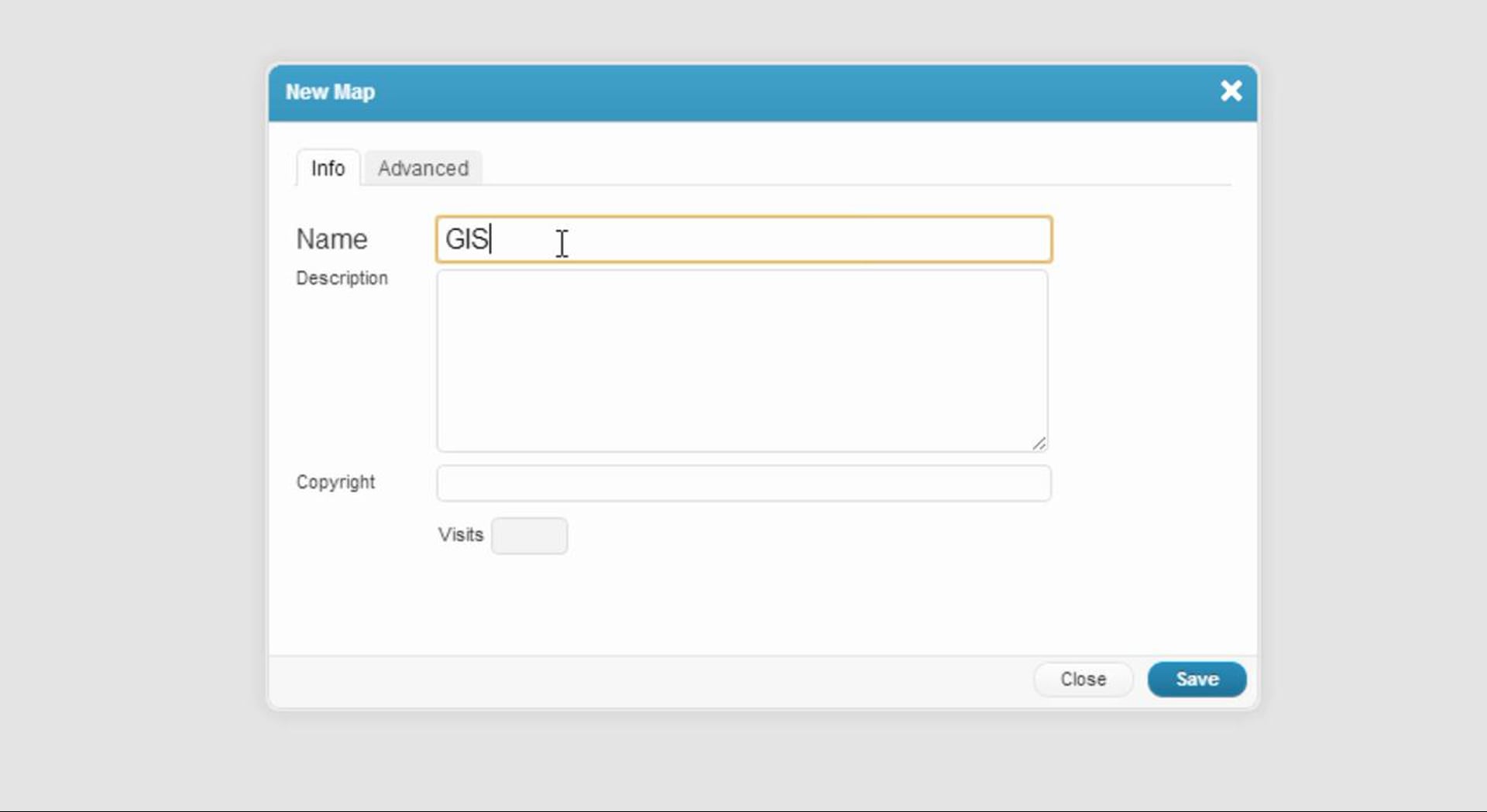
Today we would like to show you how to create a new map and manage it’s properties.