Add Geotagged Images
GIS Cloud has implemented the possibility of adding geotagged photos to your point data, where the latitude and longitude attributes (metadata) automatically create a point.
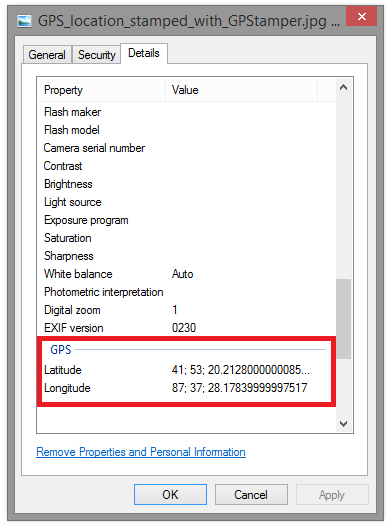
Note: Photo has to have GPS location in EXIF file (GPS latitude and longitude)
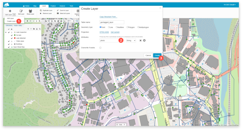
1. Create a new point layer and add one String attribute. Find more info about creating new layers.
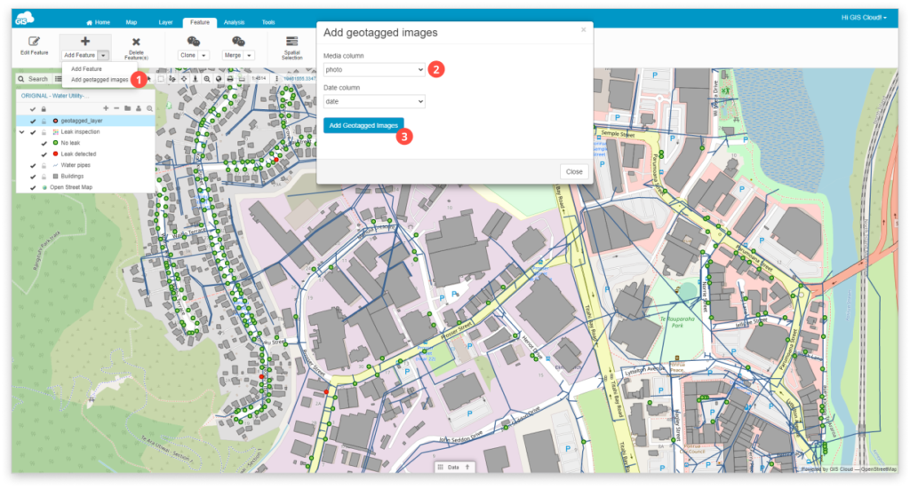
2. From the Feature tab select Add geotagged images in the dropdown menu.
3. Choose the attribute column where you want your geotagged image to be added into.
4. Select photos from the File Manager. Click the Close button once the green colour indicates the image is uploaded.
5. Double click on the layer to open Layer Properties. Go under the Display tab.
6. Click Get bounds from source and Reinitialize layer.
7. After bounds are updated click Save button.