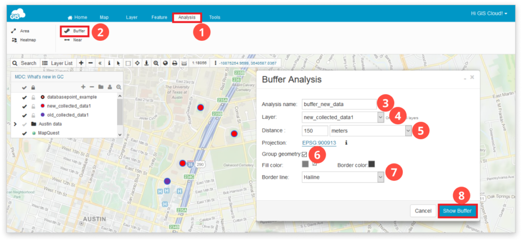
How to create a Buffer?
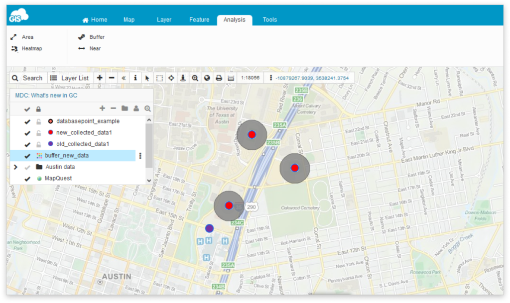
Besides the visual representation of data, one of the central functionalities of Geographic Information System is the ability to edit, analyze, connect and compare your data based on their spatial information. Buffer analysis creates buffer polygon to a specified distance around the point, line or polygon features. You can identify whether there are objects of interest inside or outside the zone and make conclusions based on this analysis.
To access analysis tools go to the Analysis tab.
Note: You can perform Analysis only with layers added to the map from the Database.
To perform Buffer analysis:
- Select the Analysis tab.
- Click the Buffer icon.
- Write Analysis name.
- Select the database layer from the dropdown to perform analysis on.
- Define buffer distance and the unit of measure.
- Choose whether you want to group (merge) buffers.
- Define the symbology of the buffer polygon.
- Click Show buffer button.
Below you can check out a short video demonstrating the use of the Buffer analysis tool.
Feel free to check out the rest of our analysis tools – Area, Heatmap and Near.