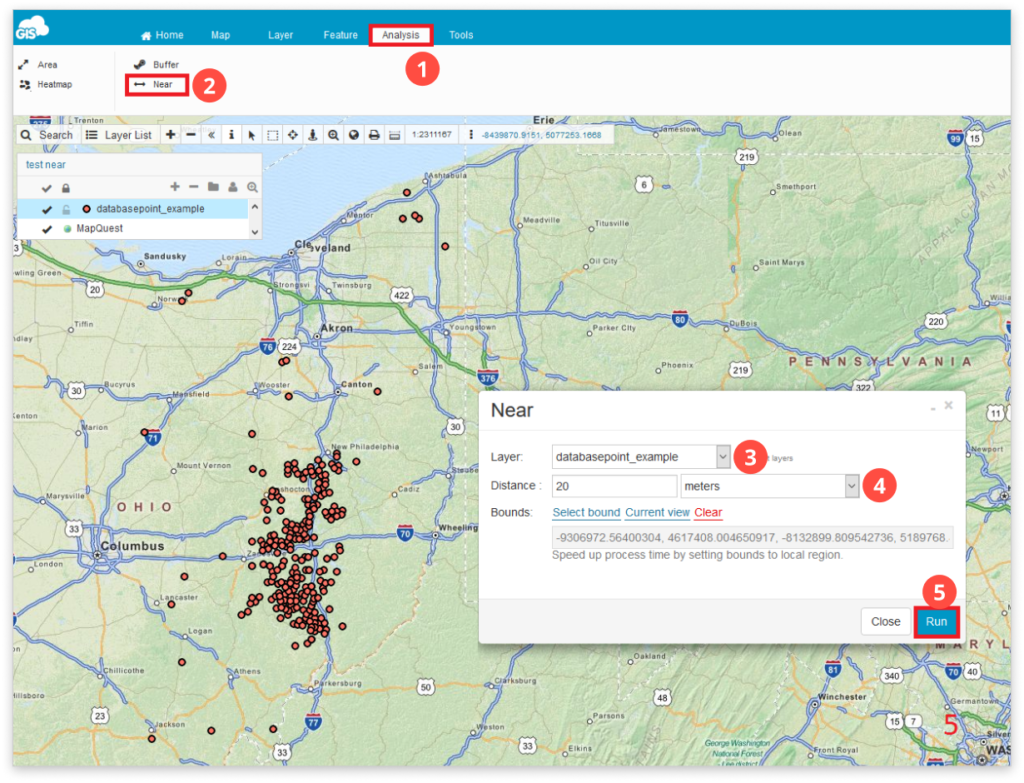
How to make Near analysis?
Besides the visual representation of data, one of the central functionalities of Geographic Information System is the ability to edit, analyze, connect and compare your data based on their spatial information. Near analysis is a tool with which you can determine the distance from each feature in a layer to the nearest feature in the same layer, within the specified search radius.
To access analysis tools go to the Analysis tab.
Note: You can perform Analysis only with layers added to the map from the Database.
To perform Near analysis:
- Select the Analysis tab.
- Click Near icon.
- Select the database point layer.
- Set distance (search radius) and units of measure. Available units of measure are: kilometers, meters, degrees and miles.
- Note: You can speed up process time by setting bounds to the local region.
- Click the Run button and features that match the parameters you set will be selected!.
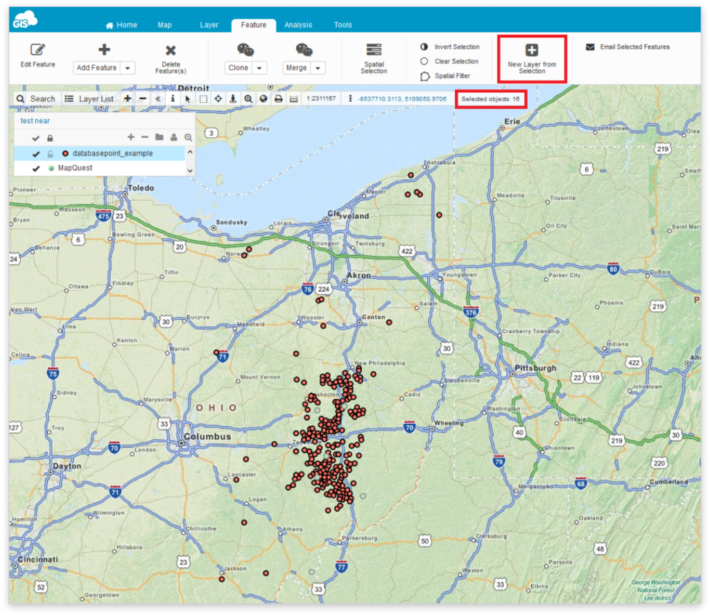
You can see the number of selected features in the Toolbar.
Also, you can create a new layer from selected features. To do it, go to the Feature tab and click on New layer from Selection.
Feel free to check out the rest of our analysis tools – Area, Buffer and Heatmap.