Spatial Selection in Map Viewer
Spatial selection allows you to create database queries using custom selection conditions. This tool allows you to select any database feature from any database layer in your Map View. It utilizes a variety of known operators and expressions which you can explore HERE and understand their usage through our examples.
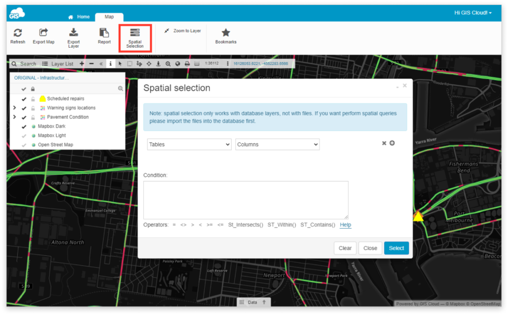
Note: Spatial selection only works with database layers, not with files. If you want to perform spatial queries please import files into the database first. Also, make sure that the multigeometry type is exploded into basic geometry.
Find Spatial Selection tool under in the Feature tab.
You can select features by attributes or by location depending on what you need.
Learn how to use Spatial Selection in Overview of Selection tools user guide.