Create Layer
Apart from using existing data, in Map Editor it is possible to create your own datasets as well.
Navigate to the Layer or Map tab, select Create Layer from the Add layer dropdown menu and a new window will open.
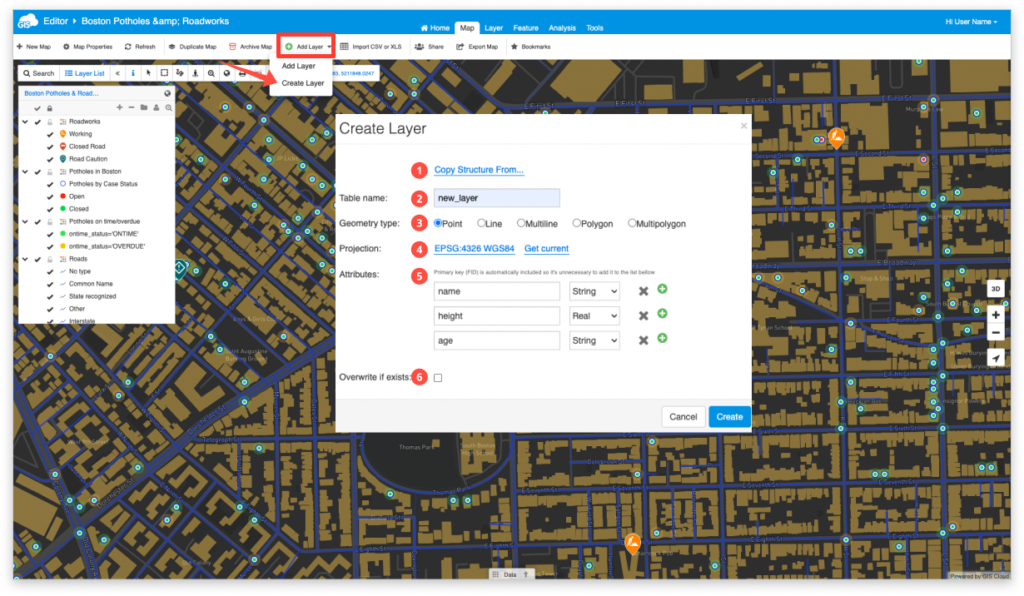
Choose or enter the data (attributes) that the layer will have:
- Copy Structure Form – You may define the structure of your data layers table by copying the attribute table from another existing layer. This operation does not define point, line or polygon geometry.
- Table name – Enter the name of your new data layer/table.
- Geometry type – Select point, line, multiline, polygon or multipolygon as your feature type.
- Projection – Select a new projection or select an existing one being used in the active map.
- Attributes – Enter the desired field names (no special characters and no spaces) for your new data layer and define the field type:
- String – Input any text
- Real – Input numbers containing a decimal point
- Integer – Input whole numbers
- Overwrite if exists – You have the option to overwrite an existing data layer/table if it bears the same name as your new data layer.
Once you create a new layer, you will want to add some features on the map. Find more information about it on our user guide.