How to import a layer into Database?
Database is the required data source for editing geometry and performing any data editing, calculations, or analysis. So if your work requires more than just data visualization, the uploaded files from the File Manager must be imported into the database.
To import a file into the database:
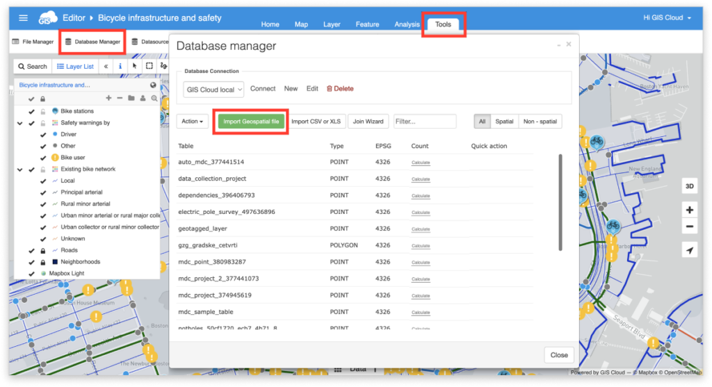
1. Click the Tools tab and click the Database Manager icon
2. Click the Import Geospatial file
3. Select the layer you want to import (or upload it to the GIS Cloud).
4. Click the Select button.
5. Define import options.
Note: When naming table:
- Start with a letter or an underscore (_)
- Use only English alphabet letters, digits and underscores
- Use only lower case
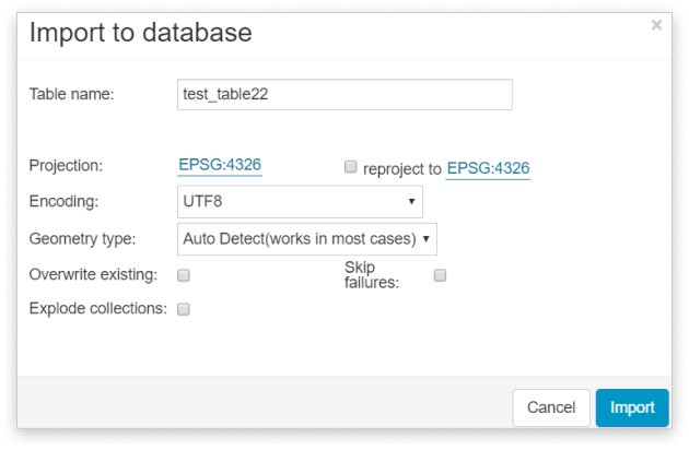
Import options:
- Projection – Info about current projection
- Reproject to – If this box is checked, it’s possible to reproject layer from original projection to another projection
- Encoding – Make sure that layer has UTF-8 encoding
- Overwrite existing – Overwrites existing table with the same name
- Explode collections – Explodes multigeometry features to the geometry (i.e. multipolygons to polygons)
- Skip failures – Skips features that can’t be imported to the database
6. After choosing the layer and defining options click the Import button.
Database is the required data source for editing geometry and performing any data editing, calculations, or analysis.
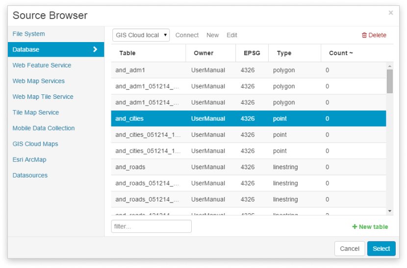
The database layer is added to a project as shown below:
- Select Add Layer from the Layer tab or Map tab.
- Select Database from the dropdown menu.
- Select a table.
- Click the Select button.
Below you can check out a short video tutorial, showing you how to upload your vector data to GIS Cloud and import it into the database.
Troubleshoot the errors while importing data into Database
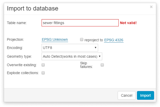
Table name is not valid
This error indicates that the name of the table is not valid. When naming a table, don’t use spaces or any special characters. Use only English alphabet letters, digits or an underscore (_). Use only lower case.
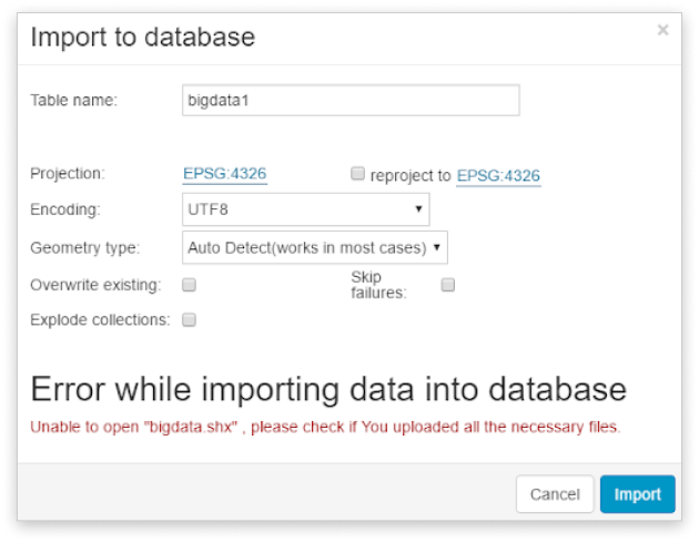
Unable to open, check if you uploaded all the necessary files
Shapefile has several mandatory files: .shp, .shx, .dbf and .prj. If some of them are missing, the layer won’t be imported into the database. Upload all the mandatory files in File Manager and try again.
Invalid geometry, please try another type
This message indicated that the system couldn’t recognize the layer’s geometry. Select an appropriate geometry type from the drop-down list and try again. This error may appear when importing the multigeometry layers. If the layer is multigeometry (multipoint, multiline or multipolygon), select the corresponding geometry type and check the ‘Explode collections’ checkbox.
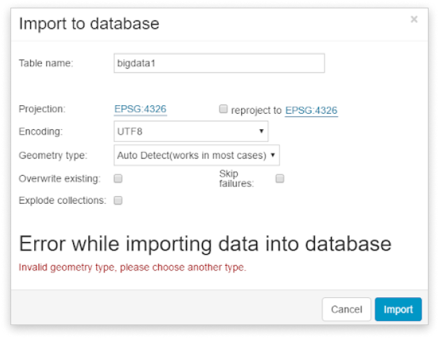
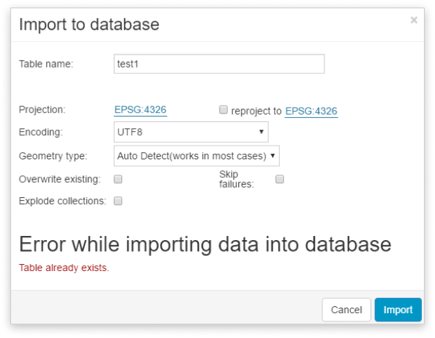
Table already exists
This message indicates that a table with the same name already exists in the database. As there can’t be two tables with the same name in the database, delete or rename the table from the database or check ‘Overwrite existing’ checkbox and try again.