Edit Attributes
Every feature in a layer that is added through Database can be edited. Whether you have a point, line, or a polygon layer, there are several ways to edit attribute data in the GIS Cloud.
Datagrid
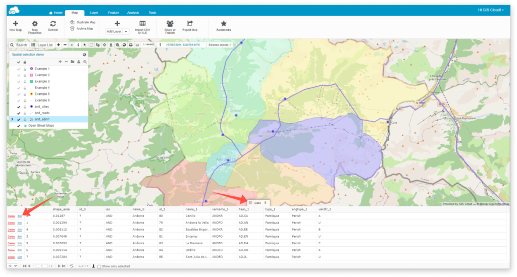
- Toggle Data Grid from the bottom of the page.
- Select feature which you wish to edit in the Data Grid.
- Select Edit
- After editing click Save
Info Panel
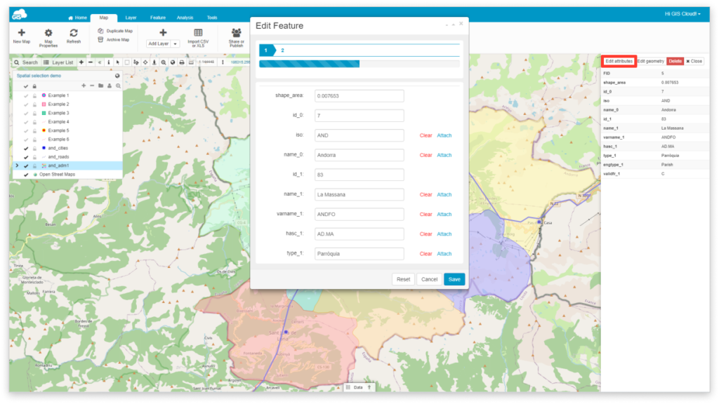
- Select a feature from the map.
- From the Info Panel select Edit attributes.
- Click Save after editing.
Info Window
Note: To activate Info window go to display attributes under the Layer Properties, Attributes tab.
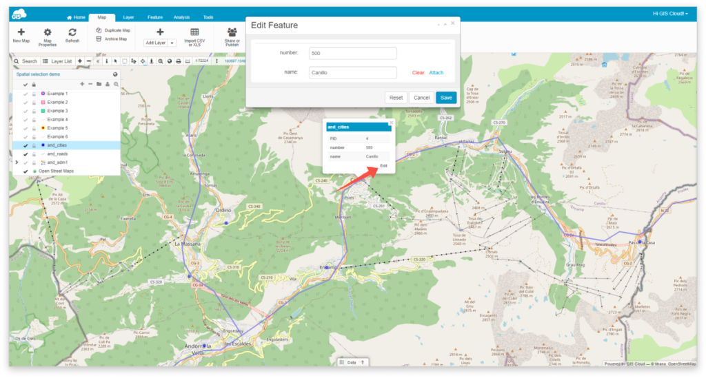
- Select a feature from the map.
- Select Edit button from the Info window.
- Click Save after editing.