How to set layer visibility for different zoom levels?
Setting different visibility for layers on the same map can be very useful – for example when working with data that covers a large area, but the data is most relevant when looking at a smaller scale. To change the layers’ zoom level display, follow these instructions:
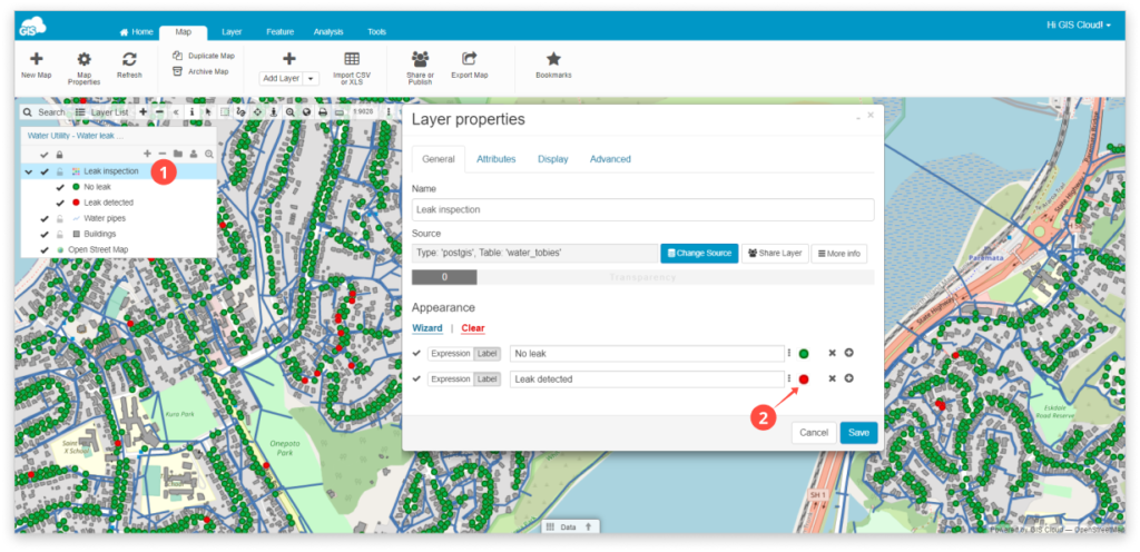
- Double-click the layer in the Layer List.
Note: If you want to hide geometry on all zoom levels, you can do it by ticking the Hide geometry box in the Advanced tab!
- Click on the symbol you want to edit.
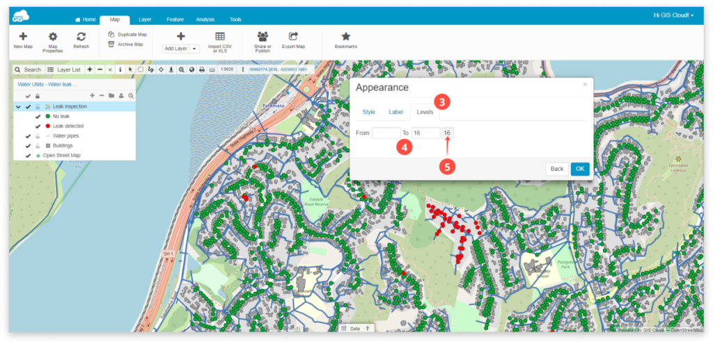
- Open the Levels tab in the Appearance window.
- Define the zoom levels you want your layer to be visible in.
- Current zoom level is displayed on the right. You can use this to determine the best level combination – zoom in/out while this modal is open to see this value change.
6. Click OK and Save.