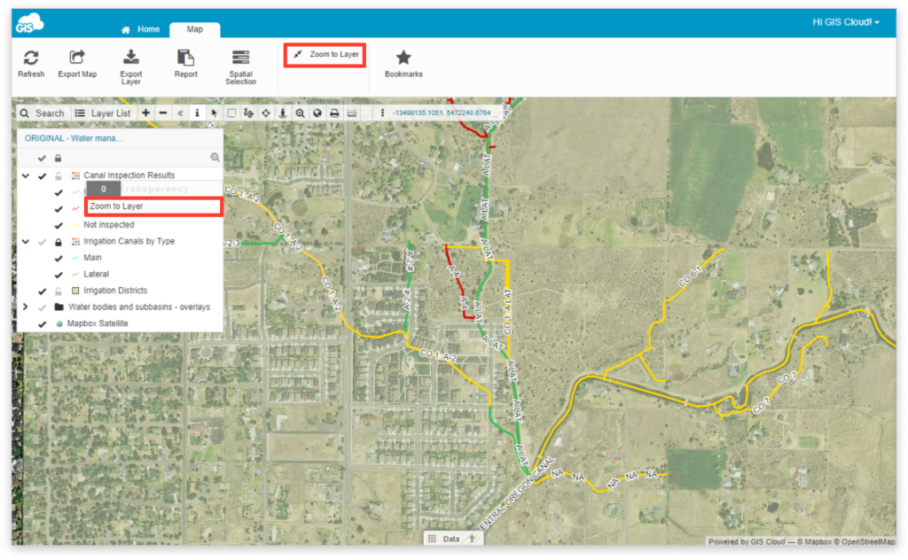
Zoom to Layer in Map Viewer
Zoom to Layer is a function that moves the view of the map, so the boundaries of layers are visible on the screen.
To use Zoom to Layer tool, go to:
- Layer tab and select Zoom to Layer
- the dropdown menu in Layer List and hit Zoom to Layer
- last icon in Layer List

This tool is useful if you are unsure of the position of the layer, or you just want a close up look of the layer.
Once you zoom into the layer, you will probably want to edit it, so check out our user guide about editing attribute data and editing geometry.
