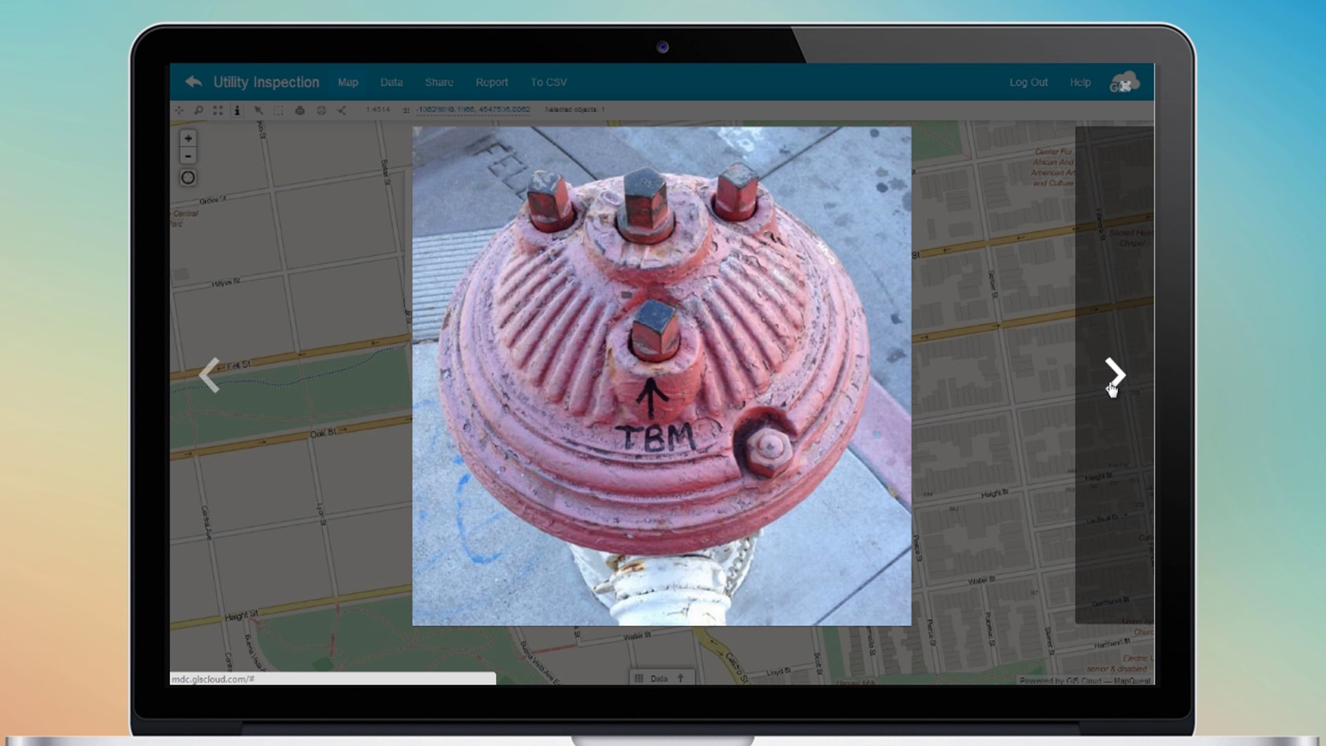
A simple and easy solution for real-time field location, multimedia and attribute data collection.
Everything you need to know about GIS Cloud apps and platform
A simple and easy solution for real-time field location, multimedia and attribute data collection.
One of the best things that Mobile Data Collection Solution offers you is the fact that all the apps work together in order to achieve the best scenario for you. Our team is continuously working on new features that make your workflow faster and better. Check out some of the cool new MDC features we just released as well as how to use the inter compatibility of our apps.
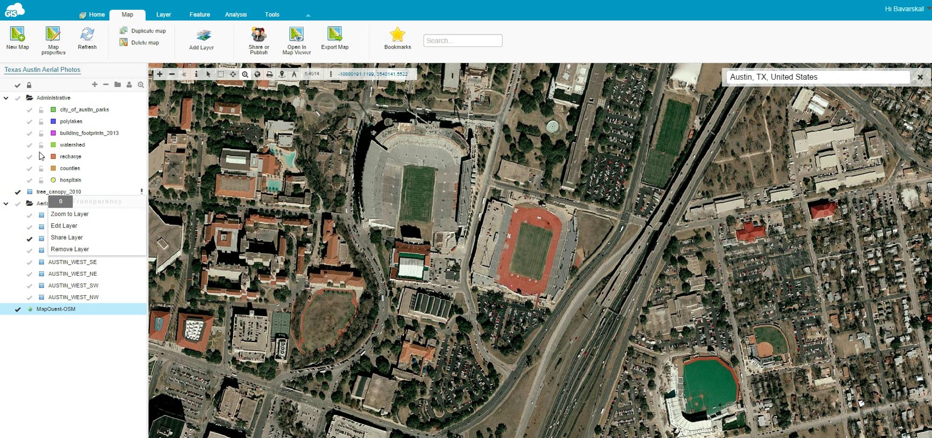
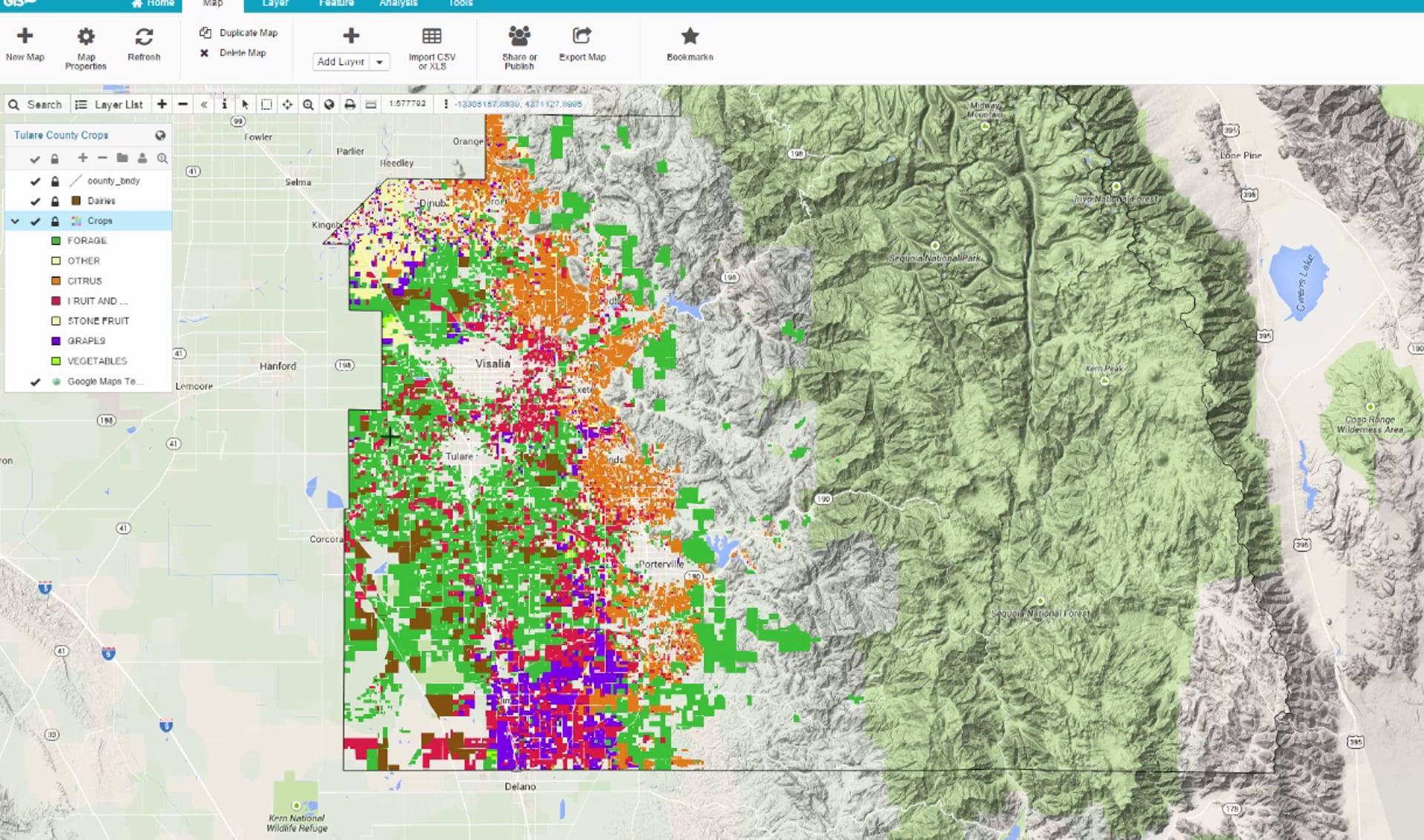
It’s all about the speed and performance of your data. The ability to overlay raster and vector datasets fast and responsive means higher efficiency and more analysis possibilities. Upload your big data to the cloud and test the fastest platform today for yourself.
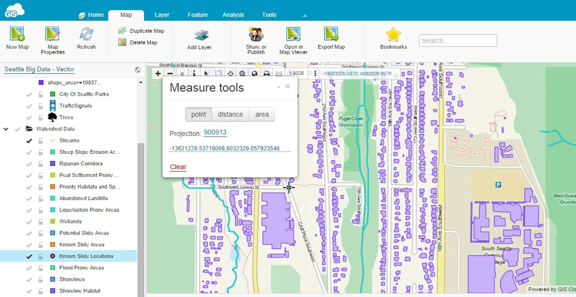
Check out our new measure tools that now gives you an option of measuring points, lines and area in feet, meters, acres, hectares and yards.
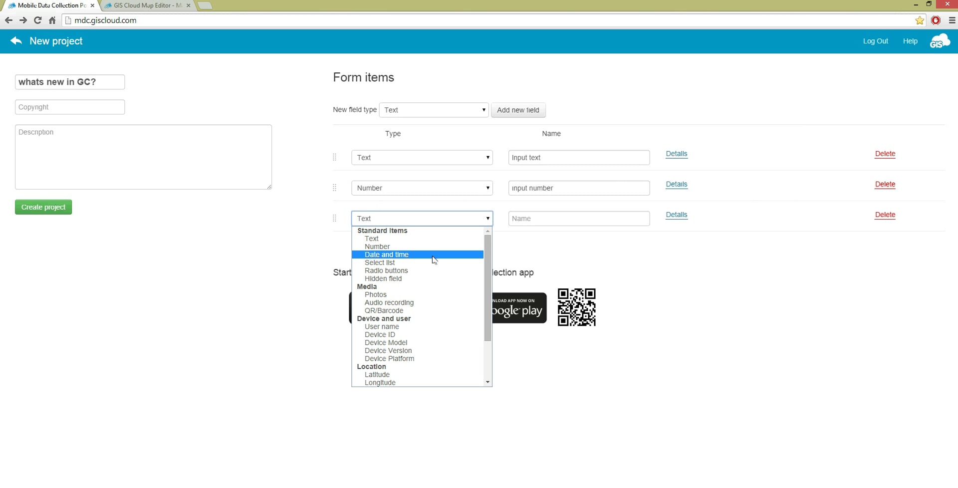
Follow these simple steps to set up dependent fields in your data collection projects. Set up criteria for your dependent fields to appear in MDC app. There are countless options for setting up your custom form with dependent fields, so give it a try and let us know your thoughts.
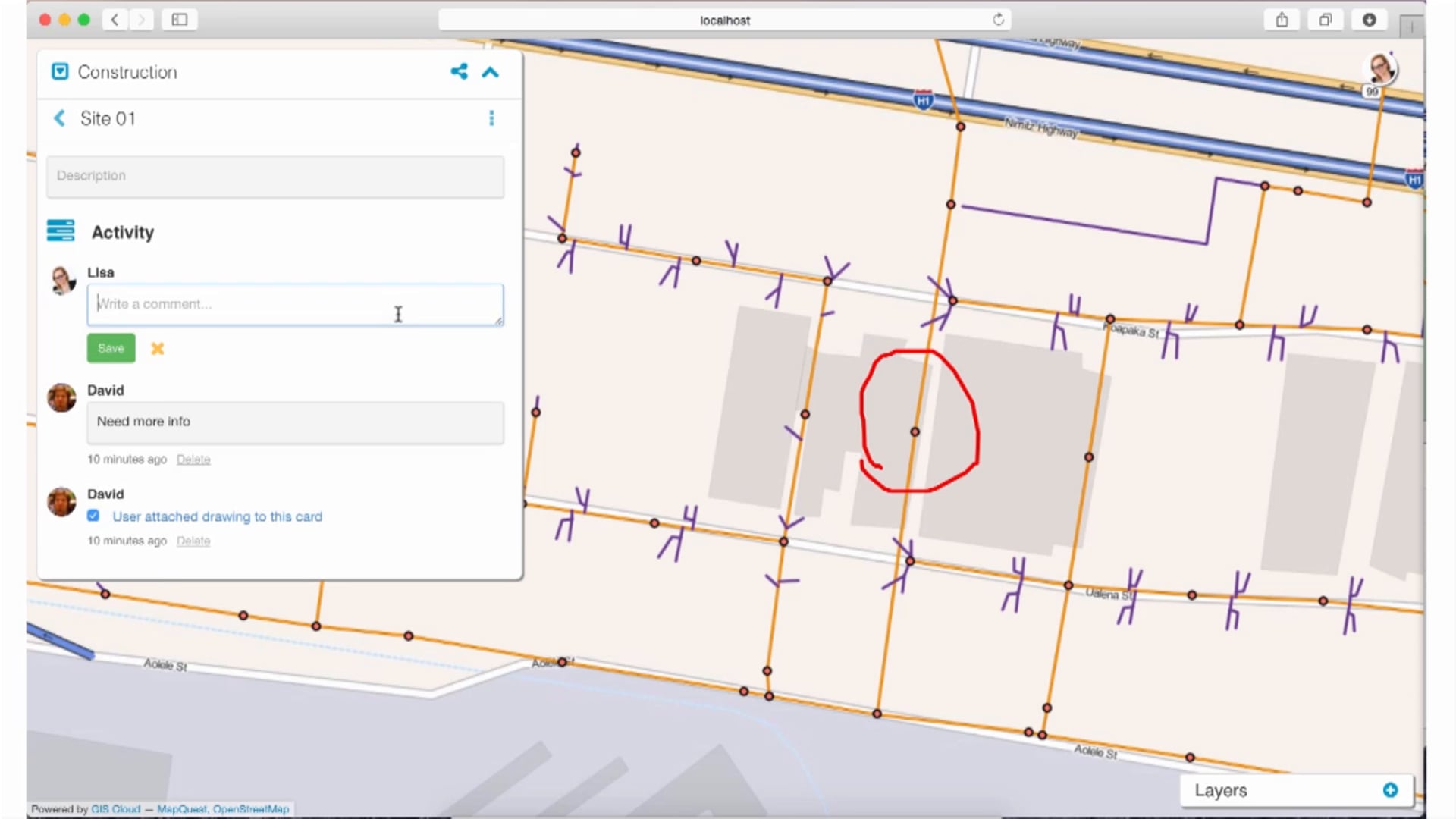
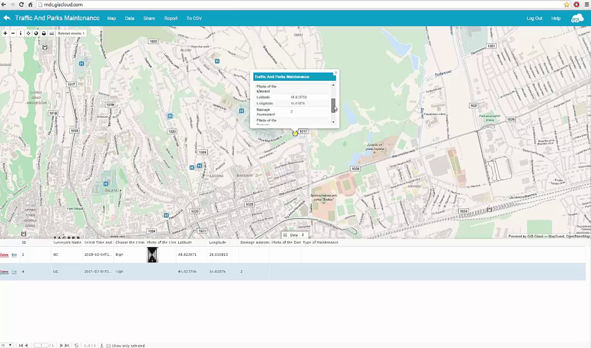
Edit your collected data right from the field and see changes in real time!
GIS Cloud presents you a short mash up of 8 user success stories coming from different locations and industries.
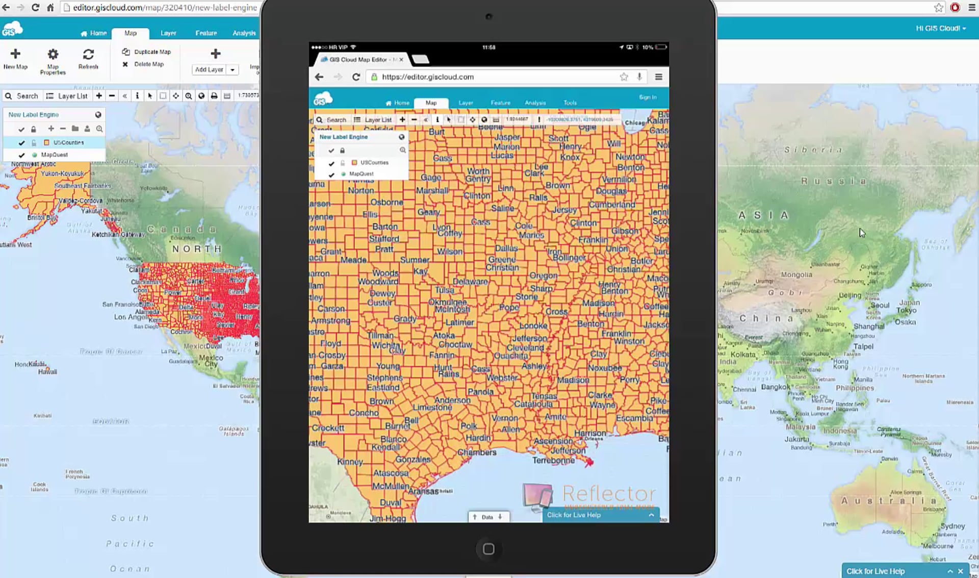
GIS Cloud presents you mind blowing labels or should we say, eye moving labels. Ever wanted to move your map and that your labels move along with your map. In other words, labels now have the possibility to change their location automatically and adapt on their own by the placement change of your map.
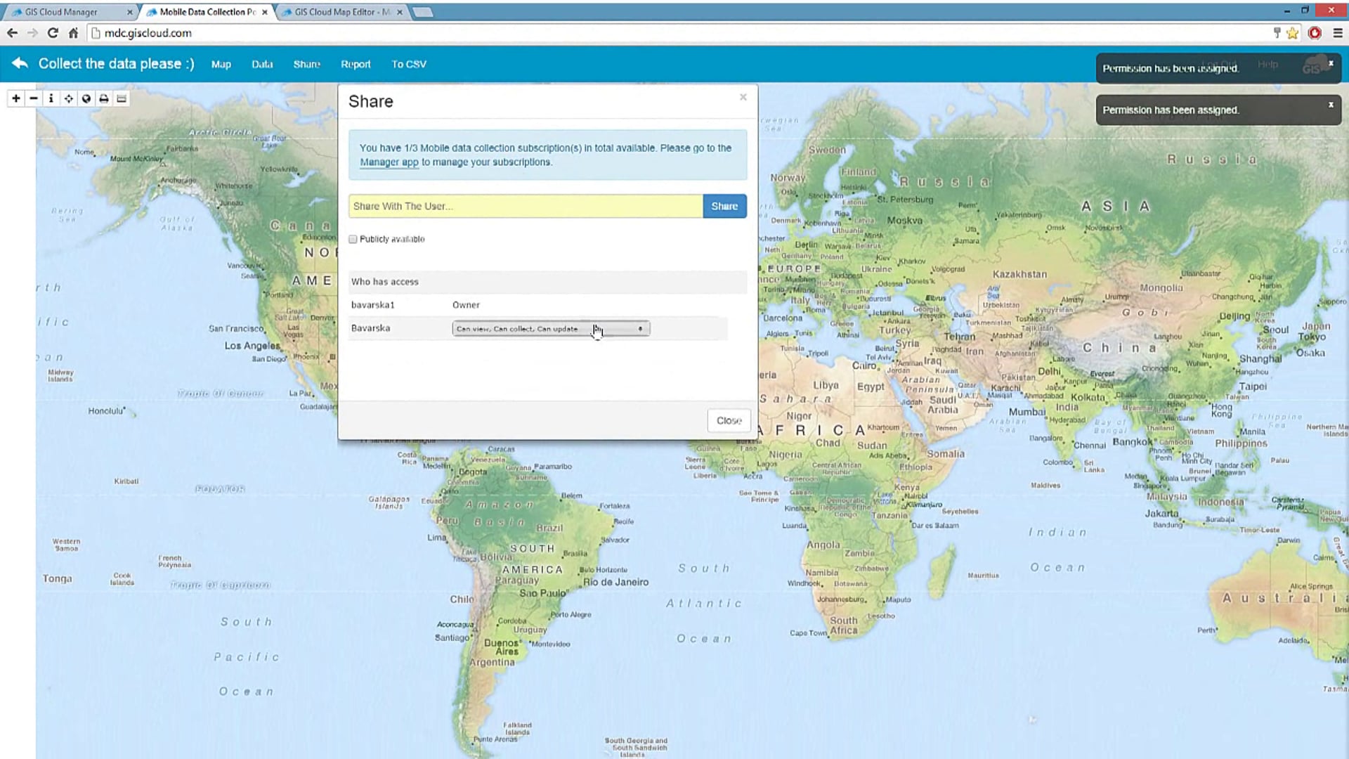
Simple steps to get yourself ready for the field data collection projects using GIS Cloud apps. If you had doubts on how to start, where to purchase apps or how to assign licenses and share maps and projects for users who will collect the data for you, this is the best place to start.
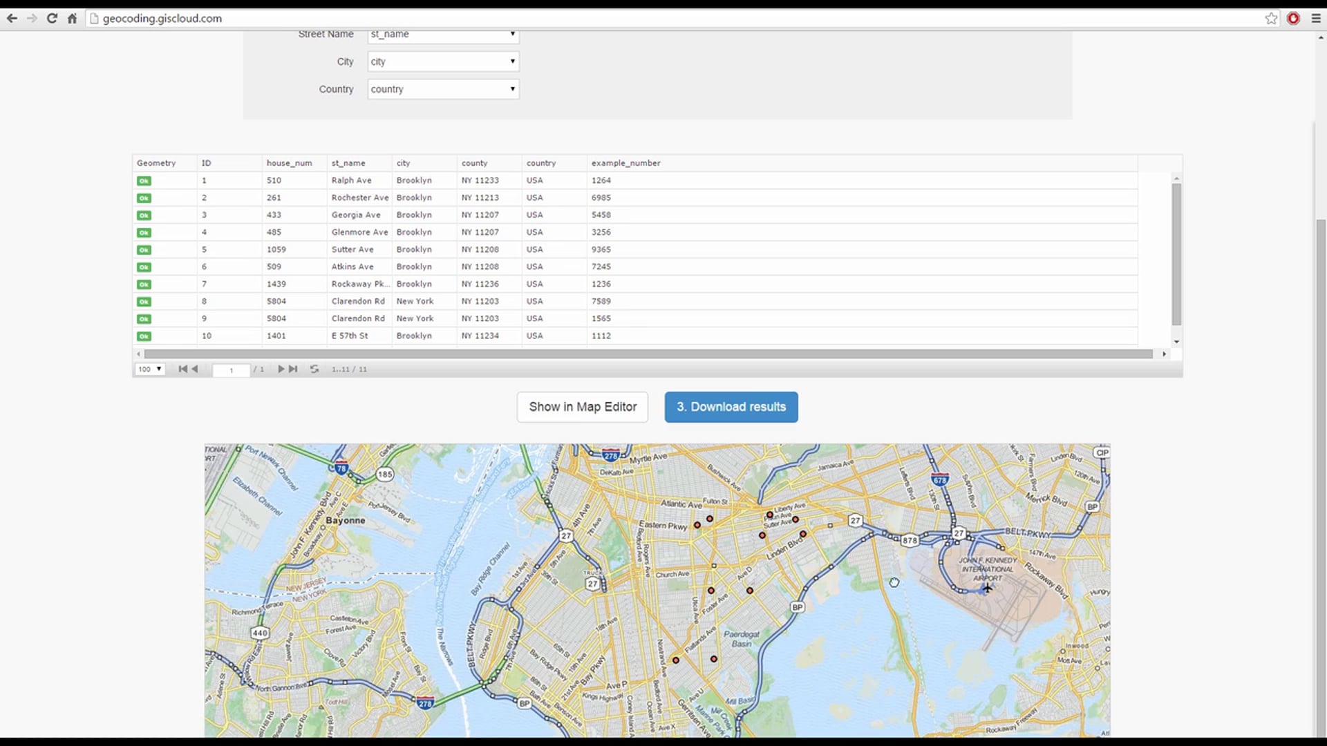
In this video we give you instructions on how to prepare your data table pripr to geocoding and steps to follow for your geocoding process. Only couple of clicks and your geocoded addresses and up and ready on a map. Download your data or continue using it in Map Editor. Be sure to try out our geocoding app for free.